Home
About Me
Contact
Evelyn Gorey Portfolio
Hi, I'm Evelyn
Cartographer, Researcher, & Data Analyst
All
Cartography & Data Visualization
Data Analysis
Web Mapping
Remote Sensing
Code Development
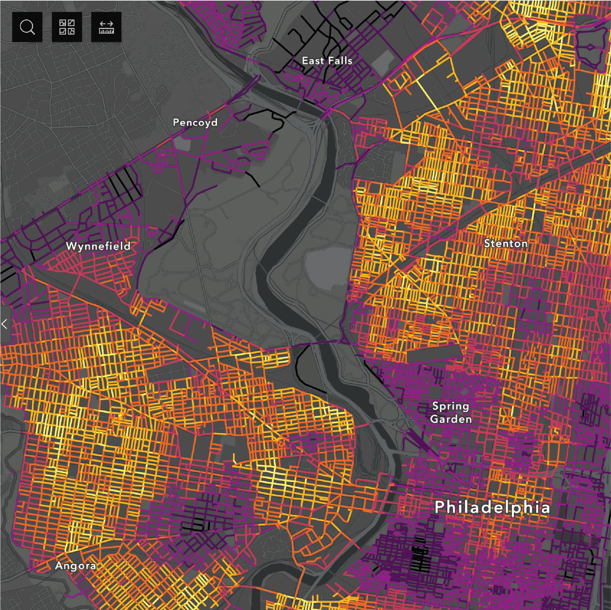
Philly Tree Plan Street Tree Opportunity Map
Web Mapping, Data Analysis
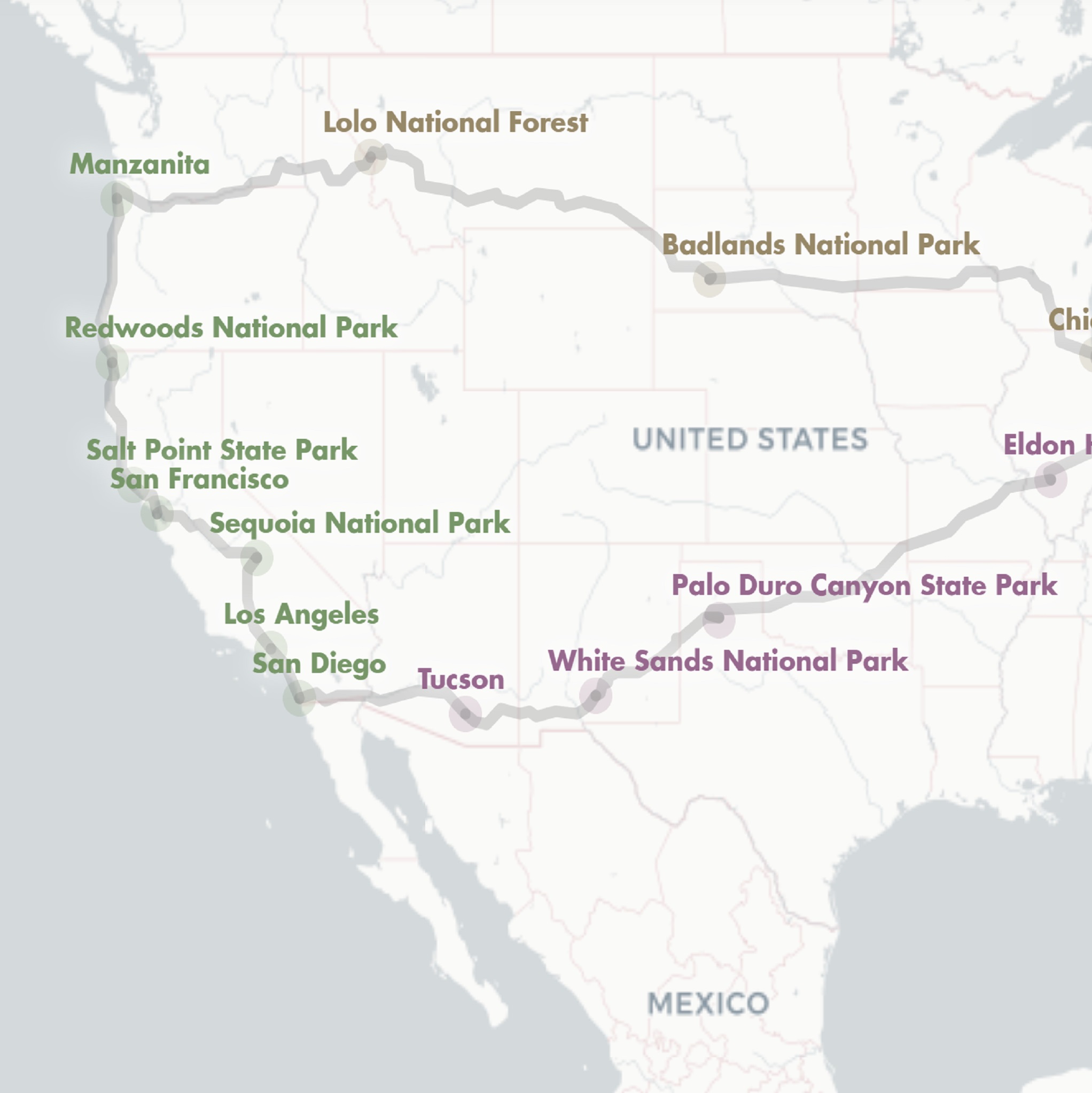
Routing a cross-country road trip with Open Source Routing Machine (OSRM)
Data Analysis, Code Development
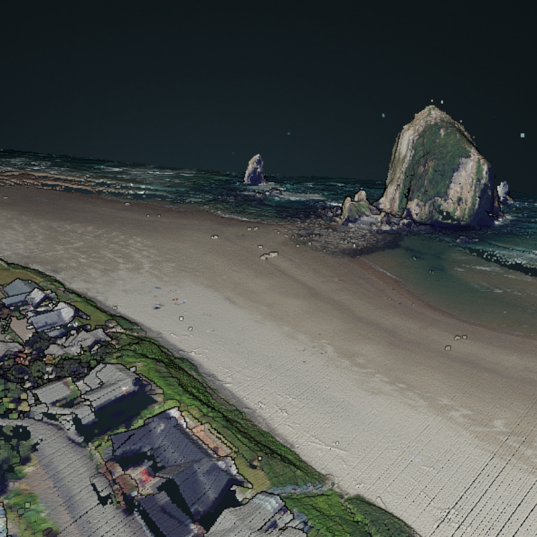
Coloring USGS point cloud data
Cartography
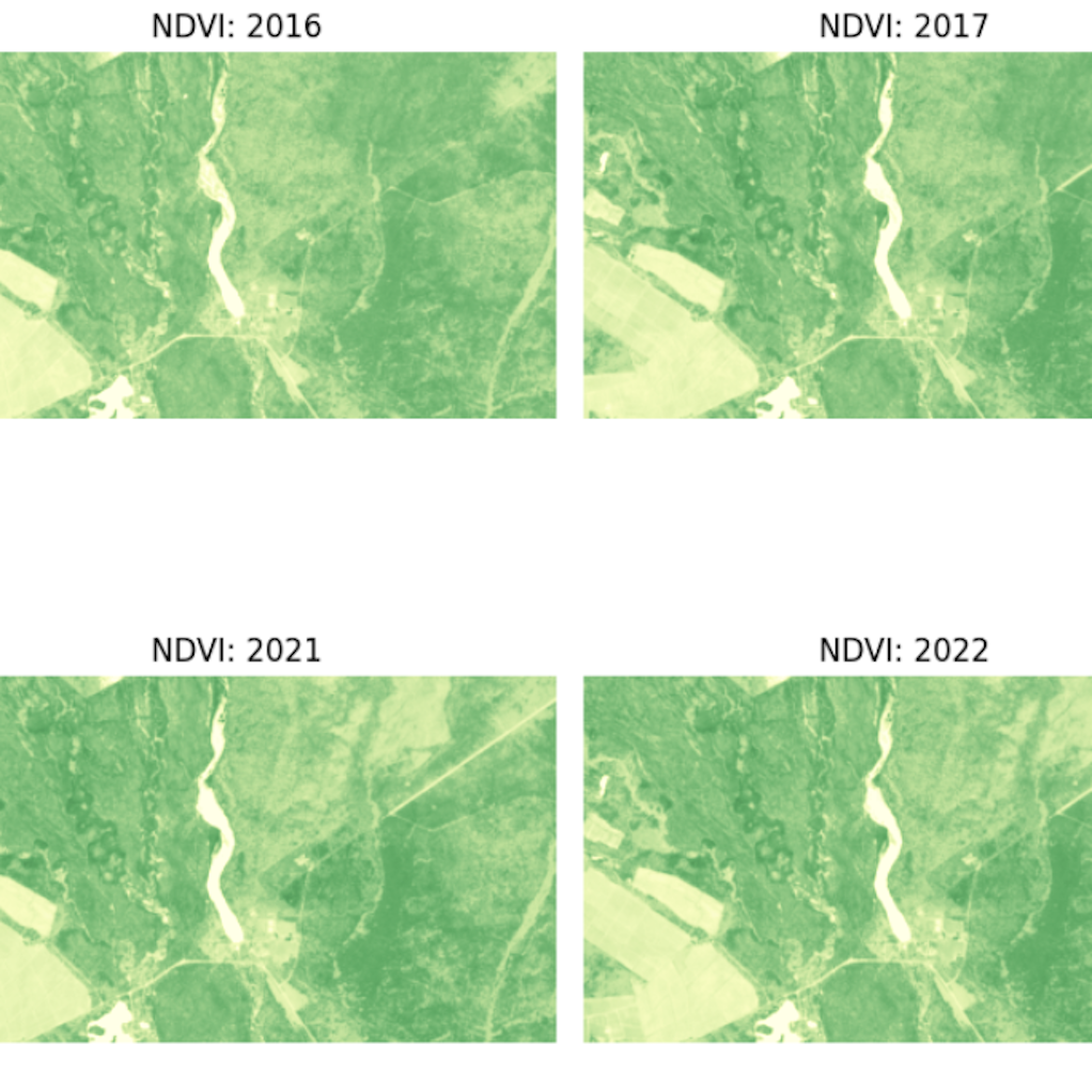
Sentinel Hub & comparing NDVI over time: an exploration of a ghost forest
Remote Sensing, Code Development
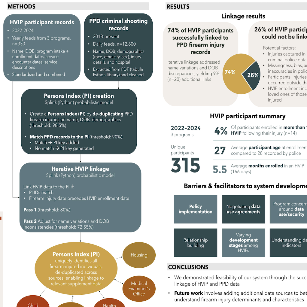
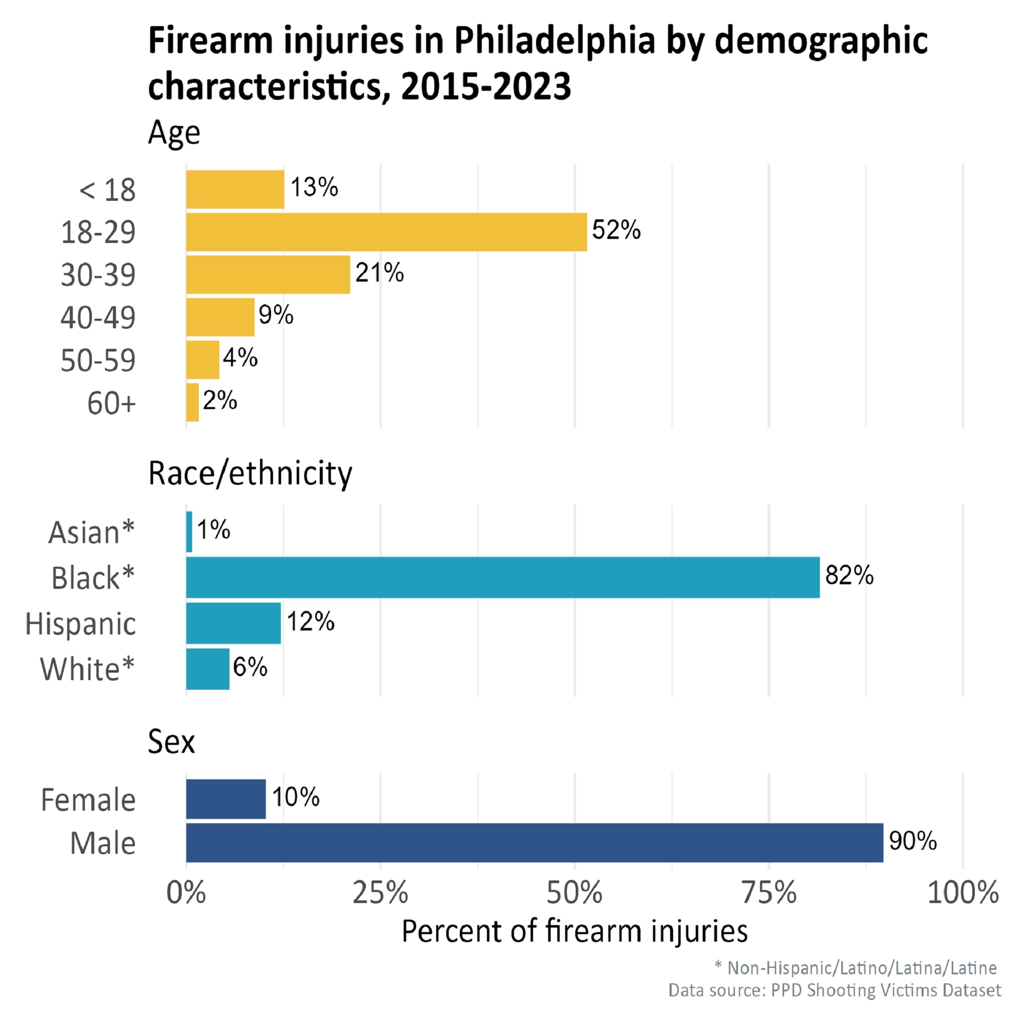
Building a local public health firearm injury data infrastructure: a Philadelphia, PA case study
Data Analysis
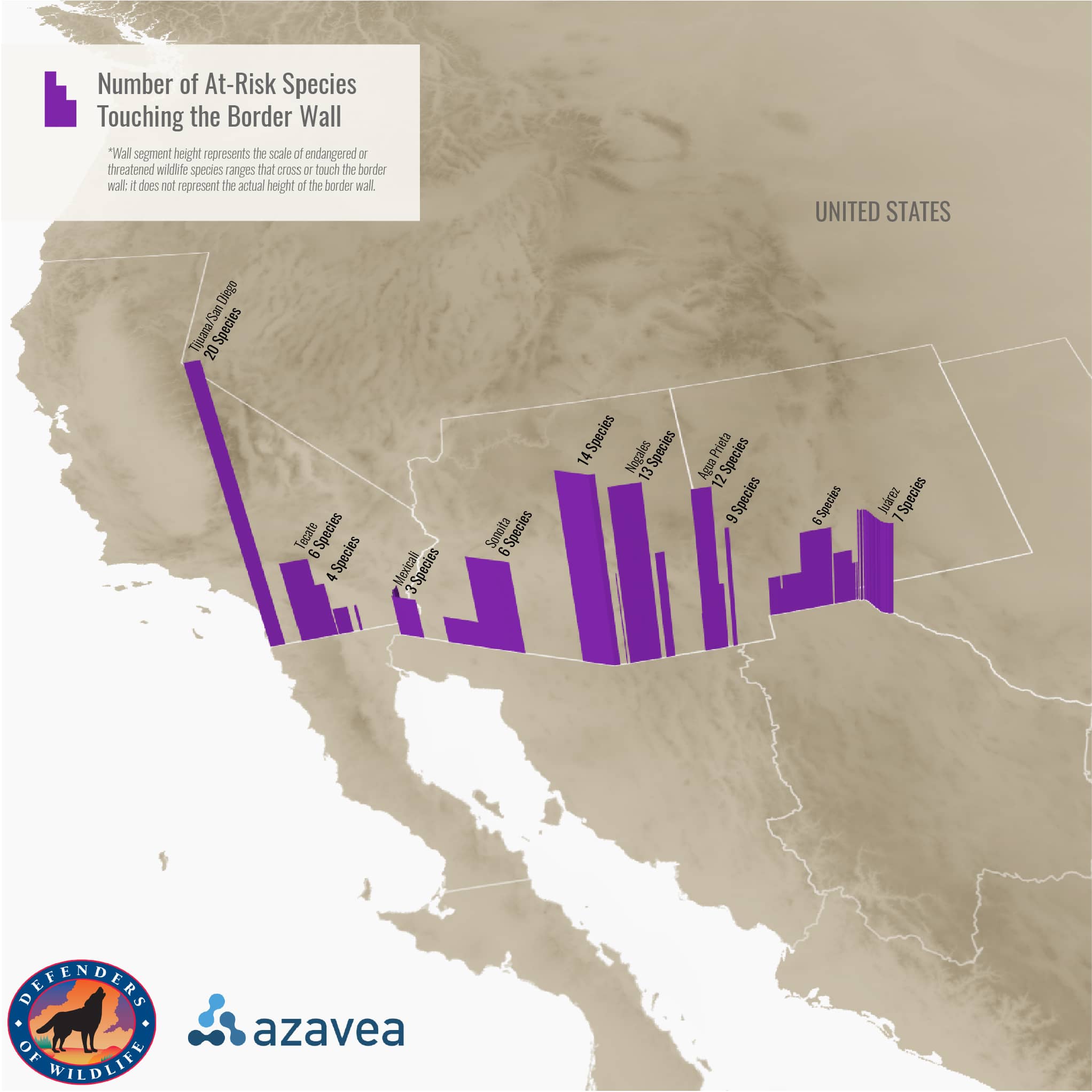
Monitoring impacts of the U.S.-Mexico border wall on endangered wildlife
Data Analysis, Cartography
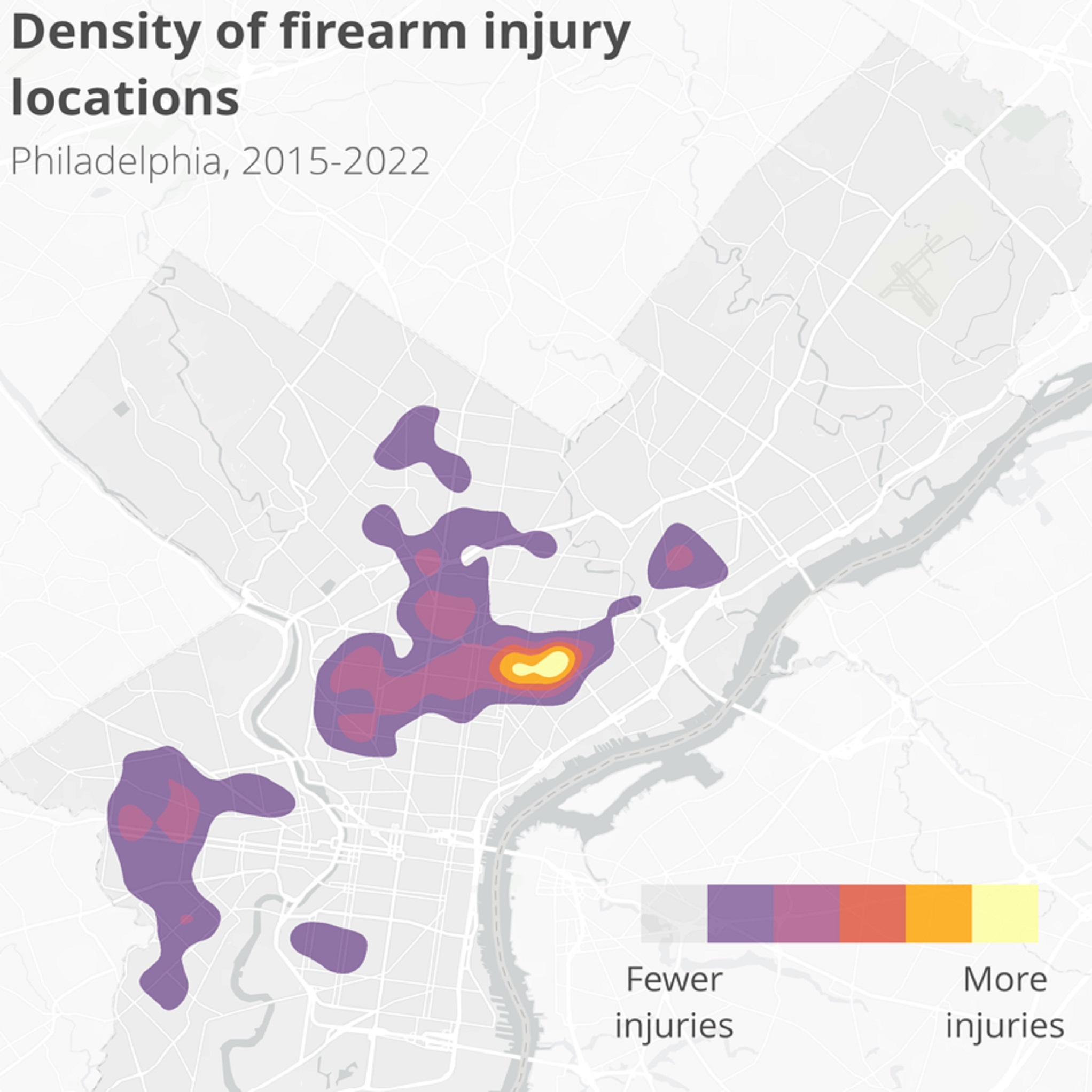
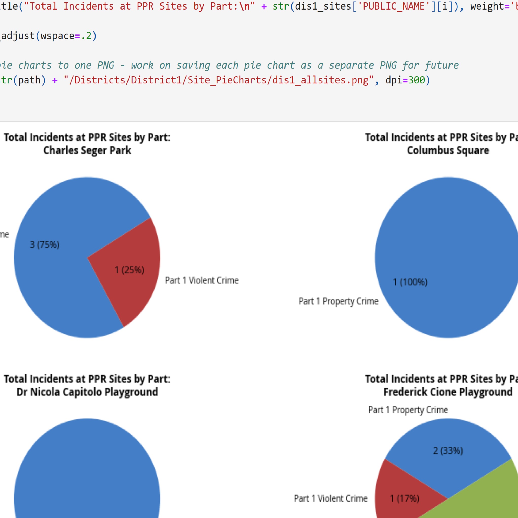
An Analysis of Victim Residences and Injury Locations in Philadelphia
Data Analysis
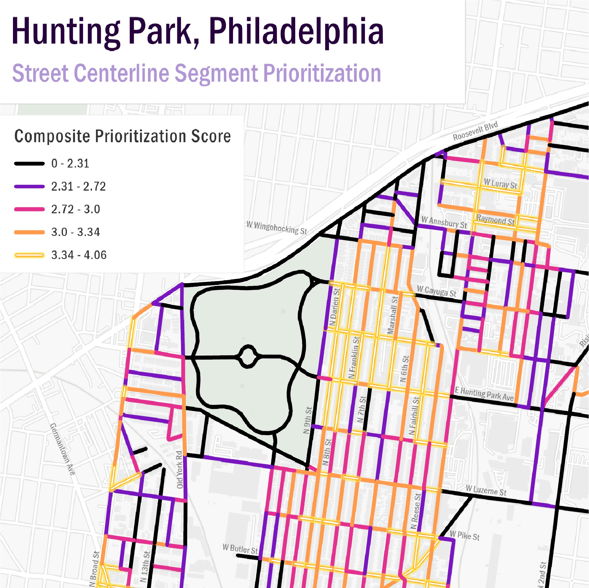
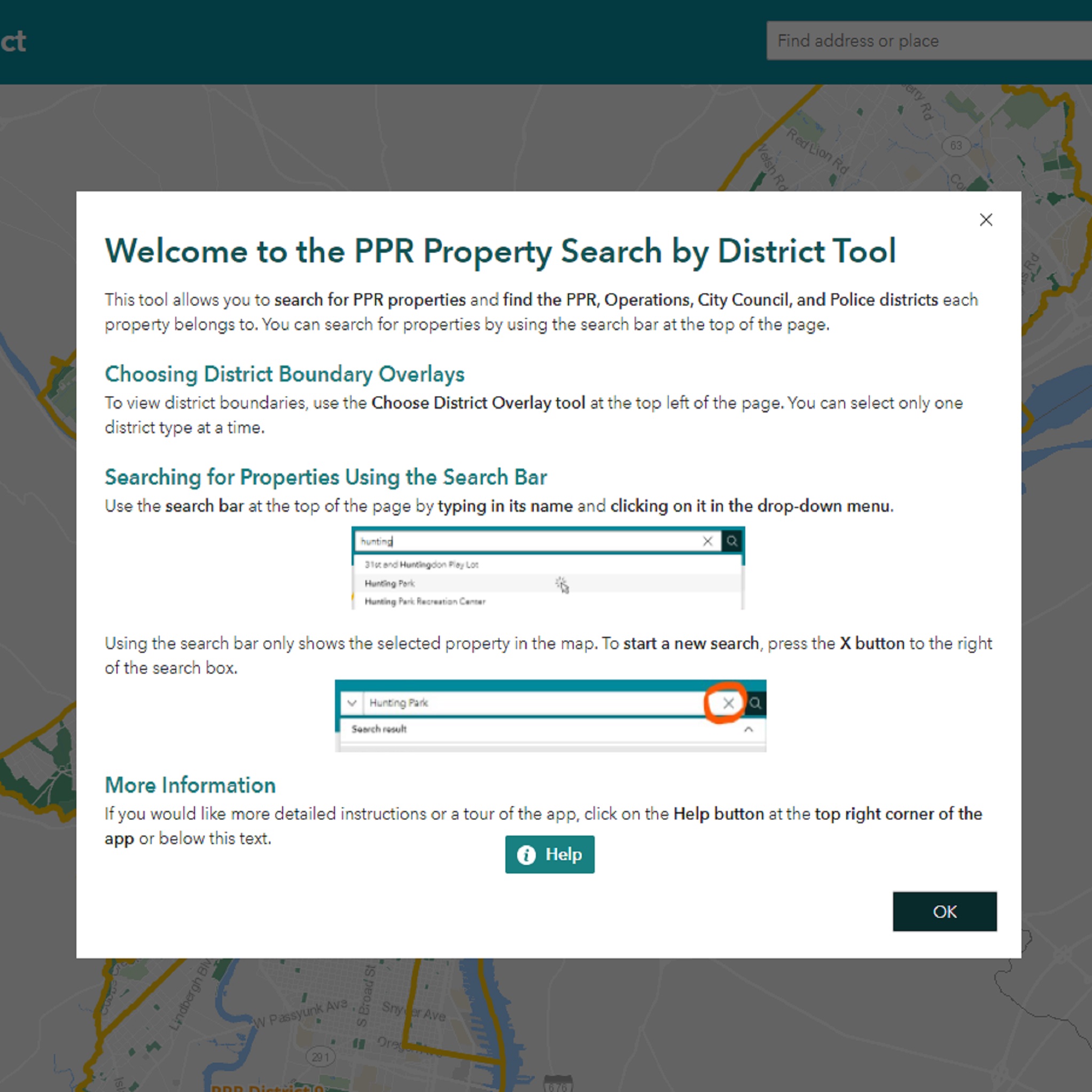
Hunting Park: A Model for Urban Cooling
Data Analysis, Cartography
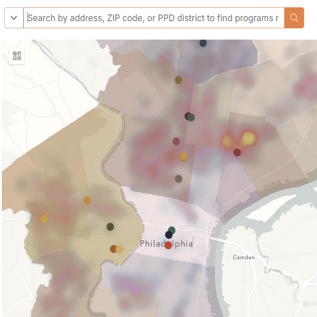
Philadelphia Community Violence Intervention Ecosystem
Web Mapping
Automating a Survey123 feature's edits & geocoding
Code Development
Relief map & LiDAR visualization of Sequoia National Park
Cartography
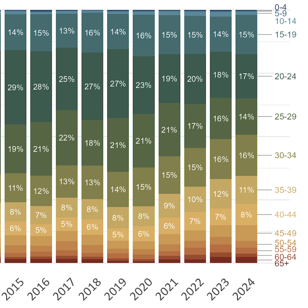
Visualizing firearm injury trends by age group over time
Data Visualization
Accessing ACS data through the census API and mapping with folium
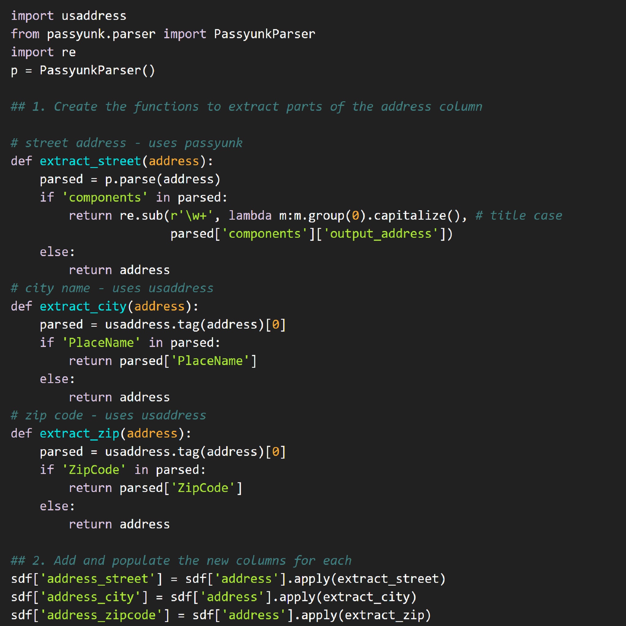
Data Analysis, Code Development
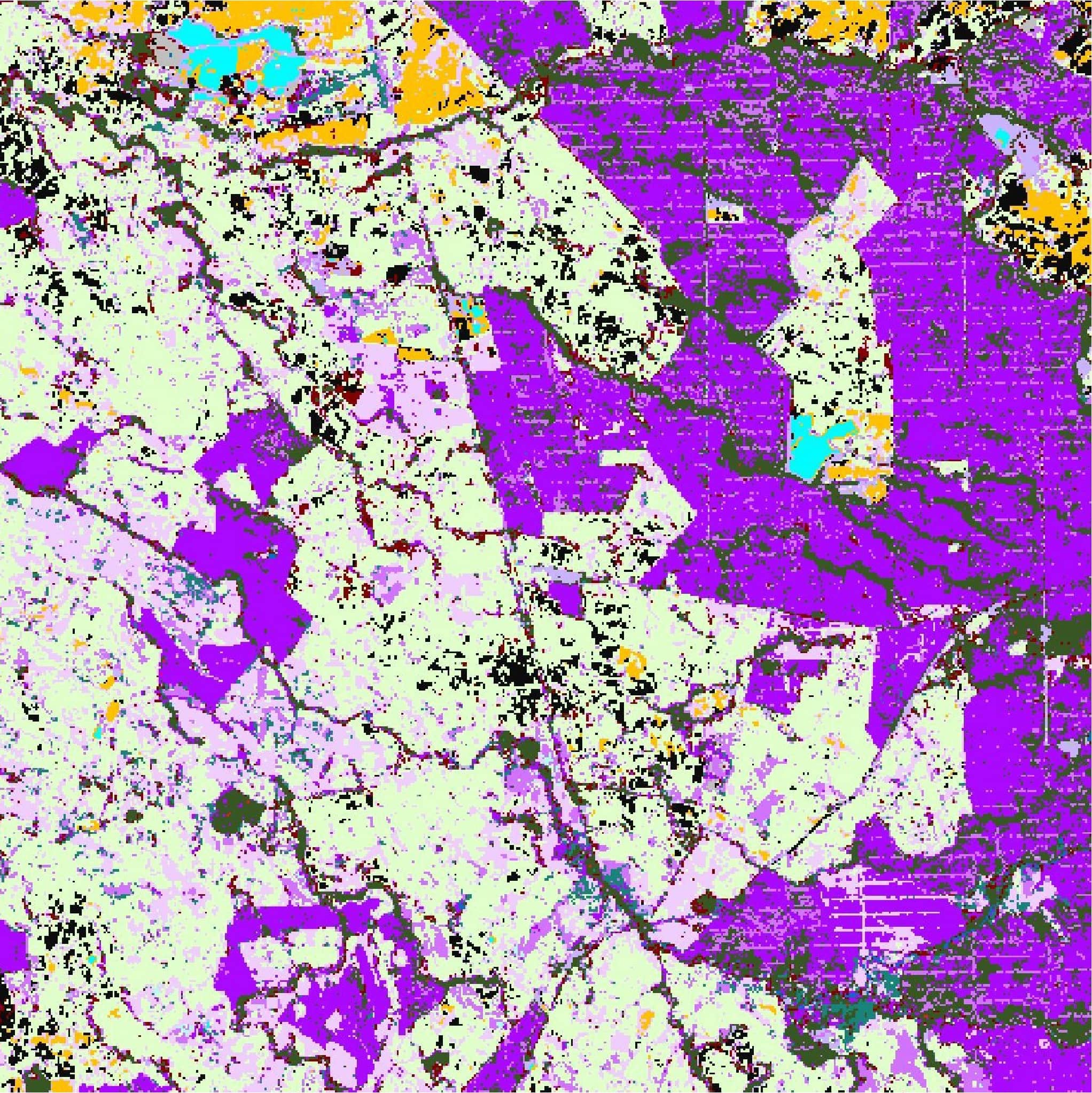
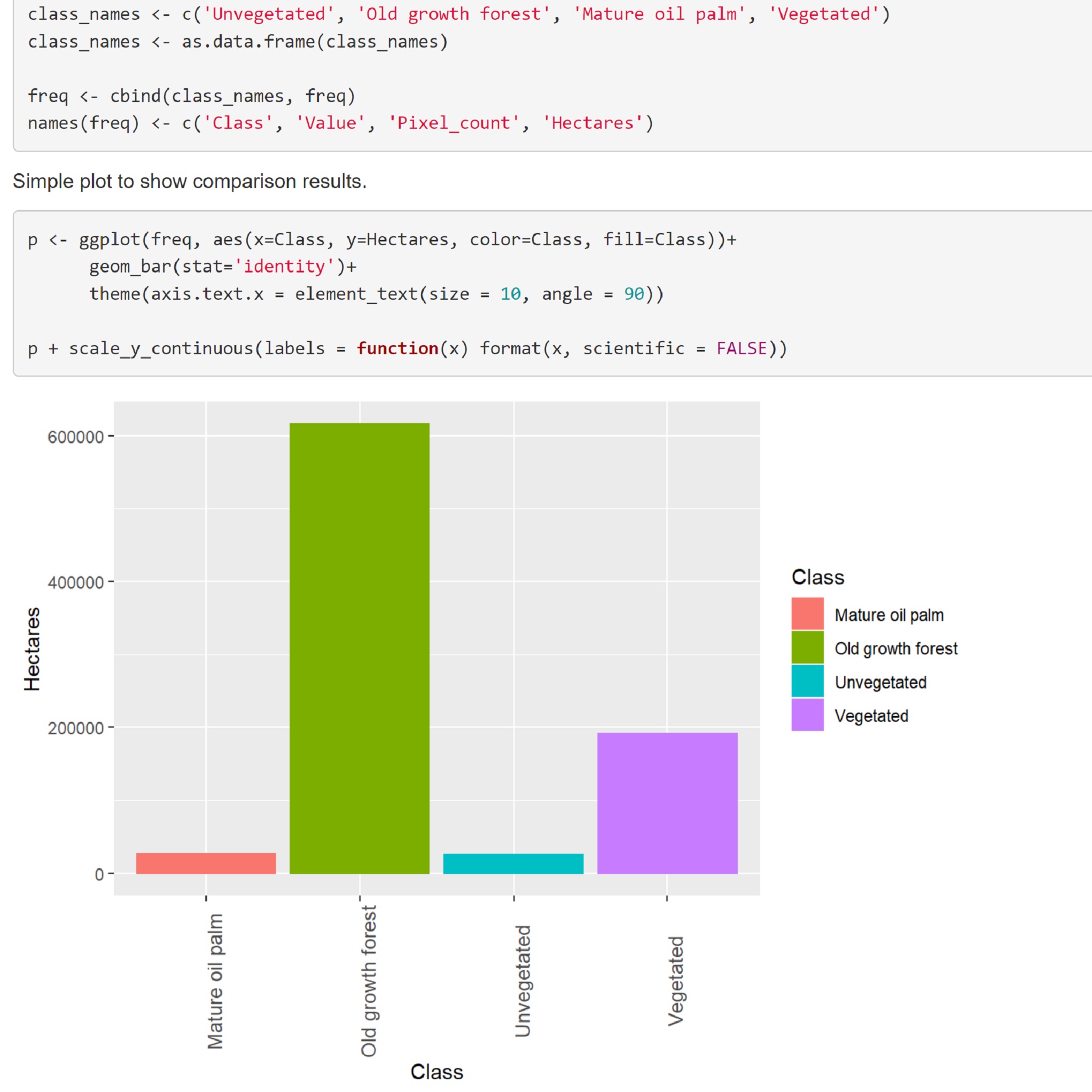
Mapping Drivers of Ecosystem Change in Colombia
Remote Sensing
Creating shared axes bar plots with patchwork and ggplot2
Code Development, Data Visualization
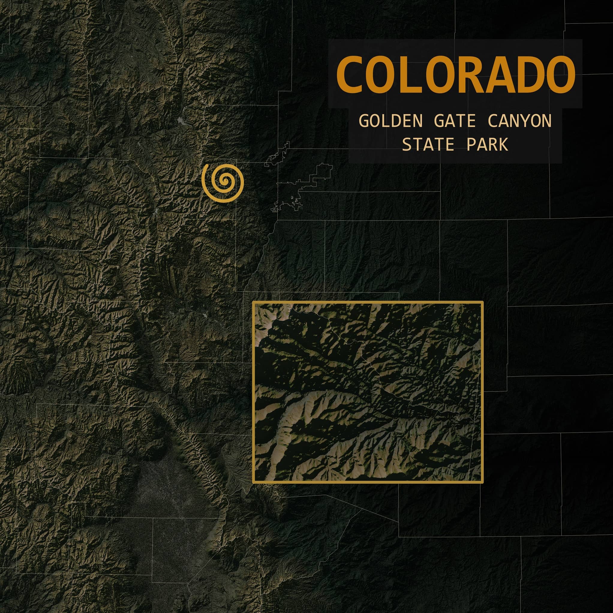
Relief maps of U.S. states & national parks
Cartography
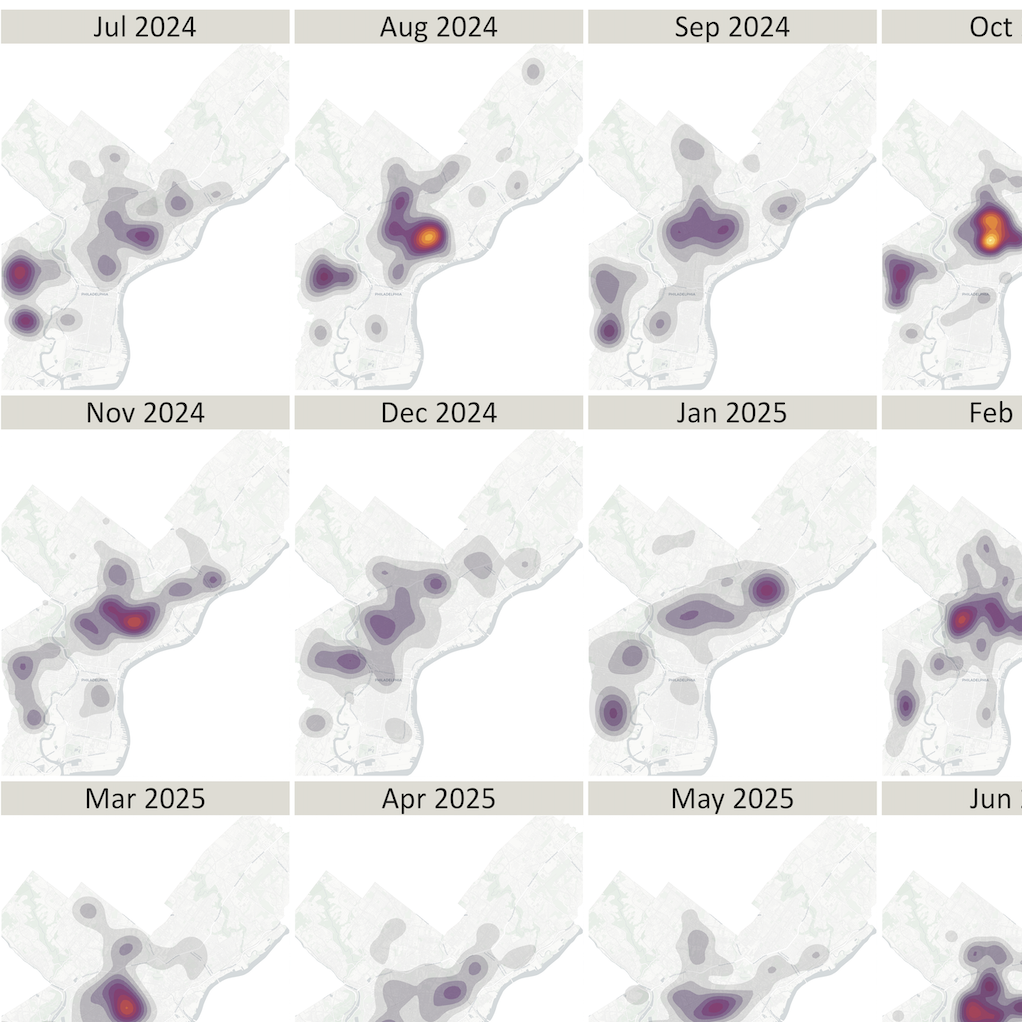
Community review of firearm injuries in 2024-2025
Code Development, Data Visualization
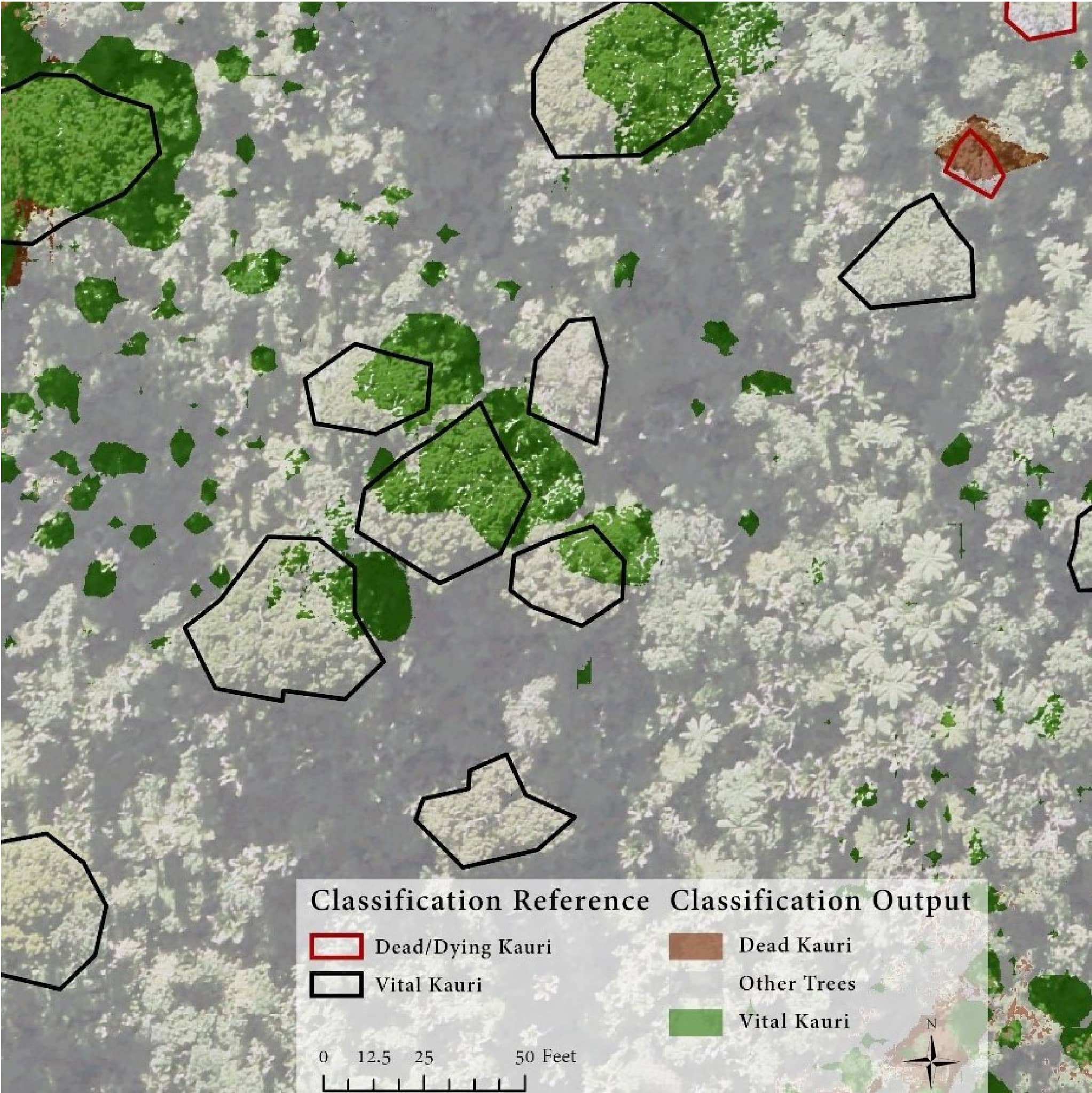
Kauri Dieback Analysis: Waitakere Ranges, Aotearoa/New Zealand
Remote Sensing
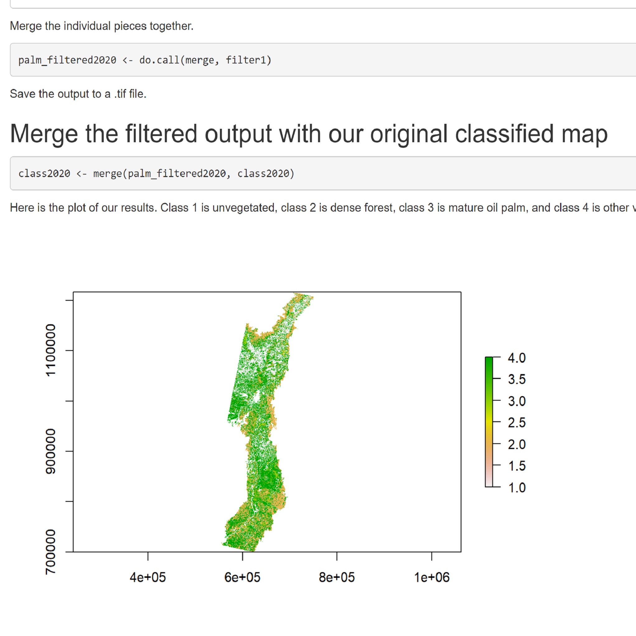
Post-classification natural forest change analysis
Remote Sensing, Code Development
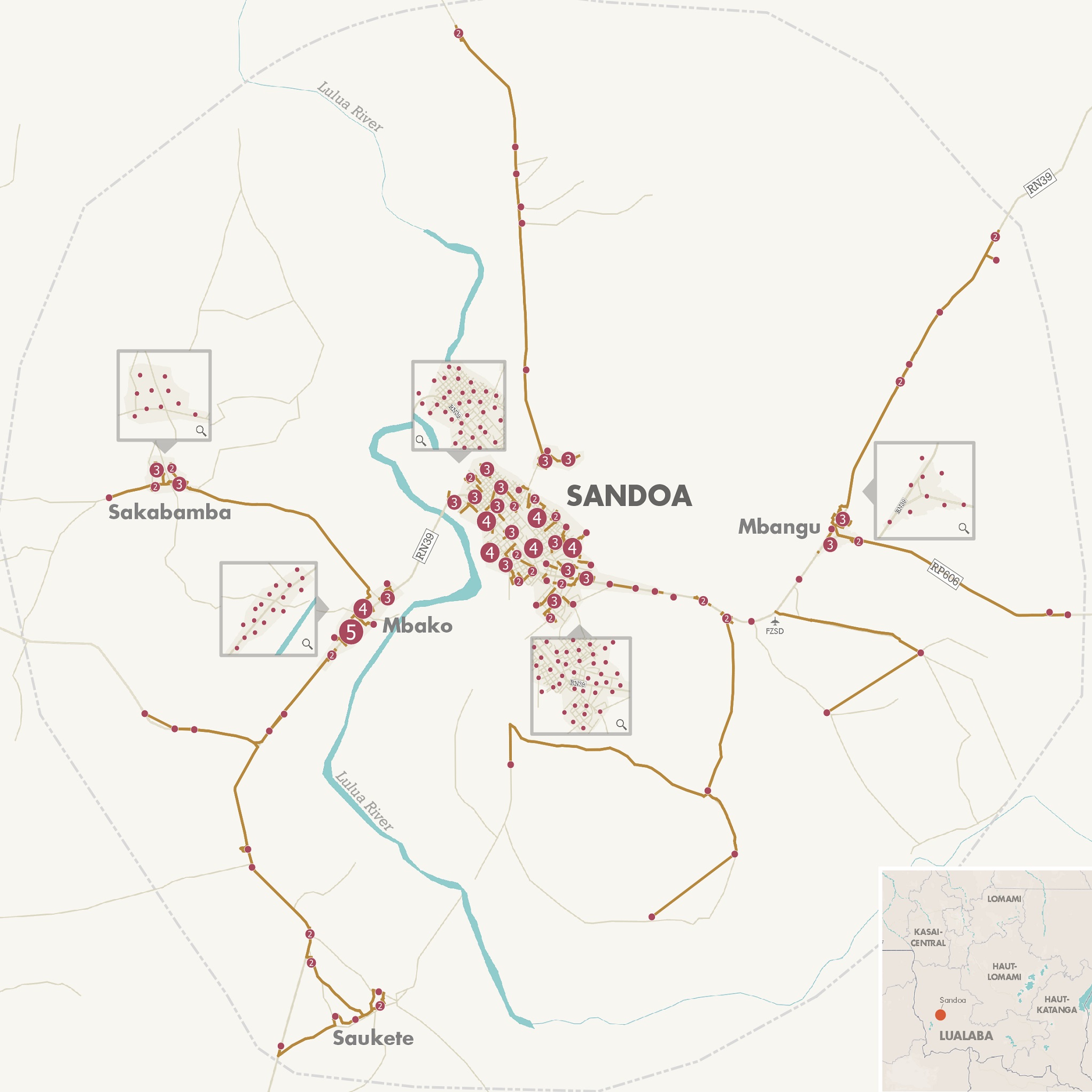
Static maps for NRECA International's National Least Cost Planning project in the DRC
Cartography
Post-classification spatial filtering
Remote Sensing, Code Development
Philadelphia neighborhood posters for community collaboration
Cartography
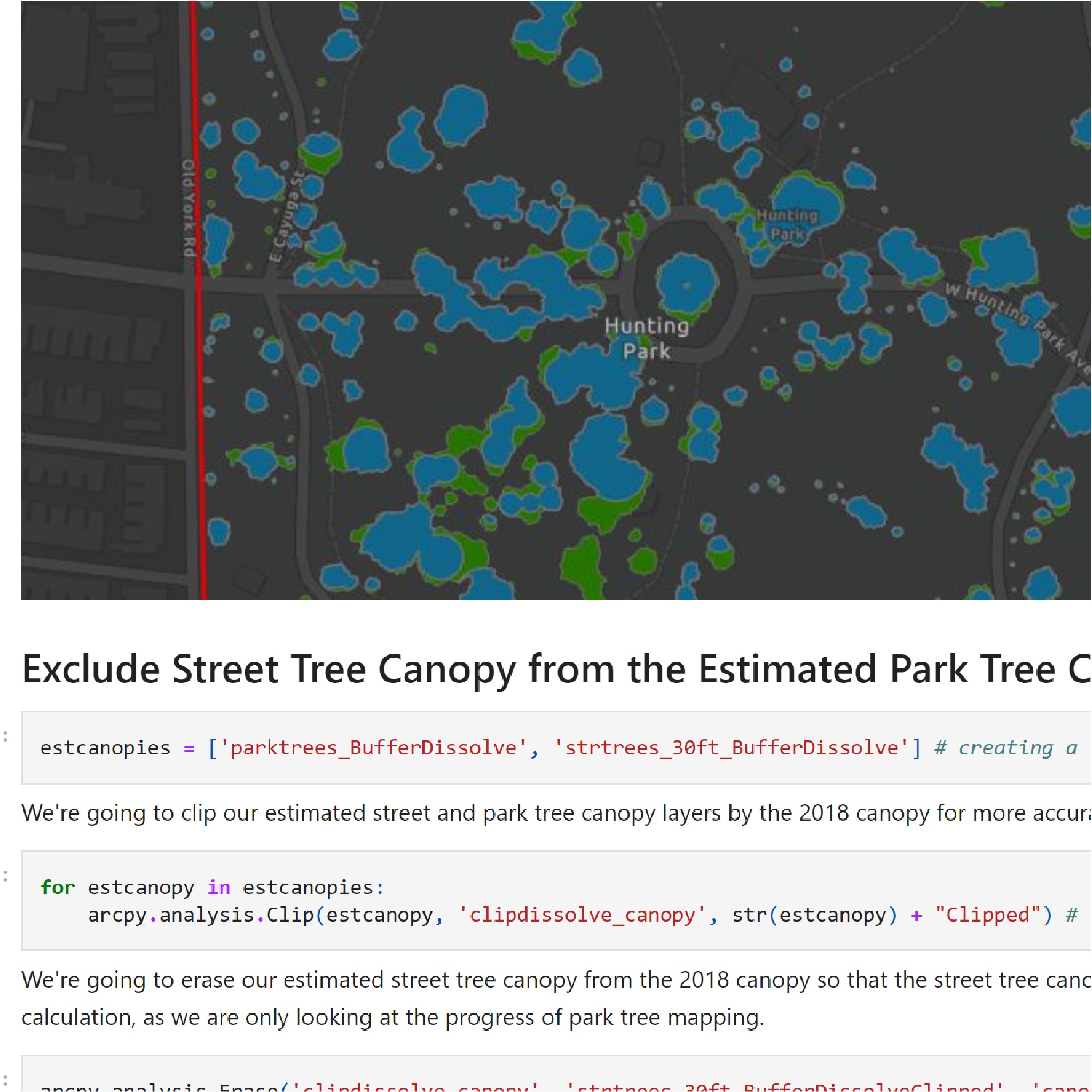
Park tree mapping progress
Data Analysis, Code Development
Mass-producing stylized charts and tables with pandas, matplotlib, and HTML + CSS
Code Development
Topography study: Svolvær, Nordland, Norway
Cartography
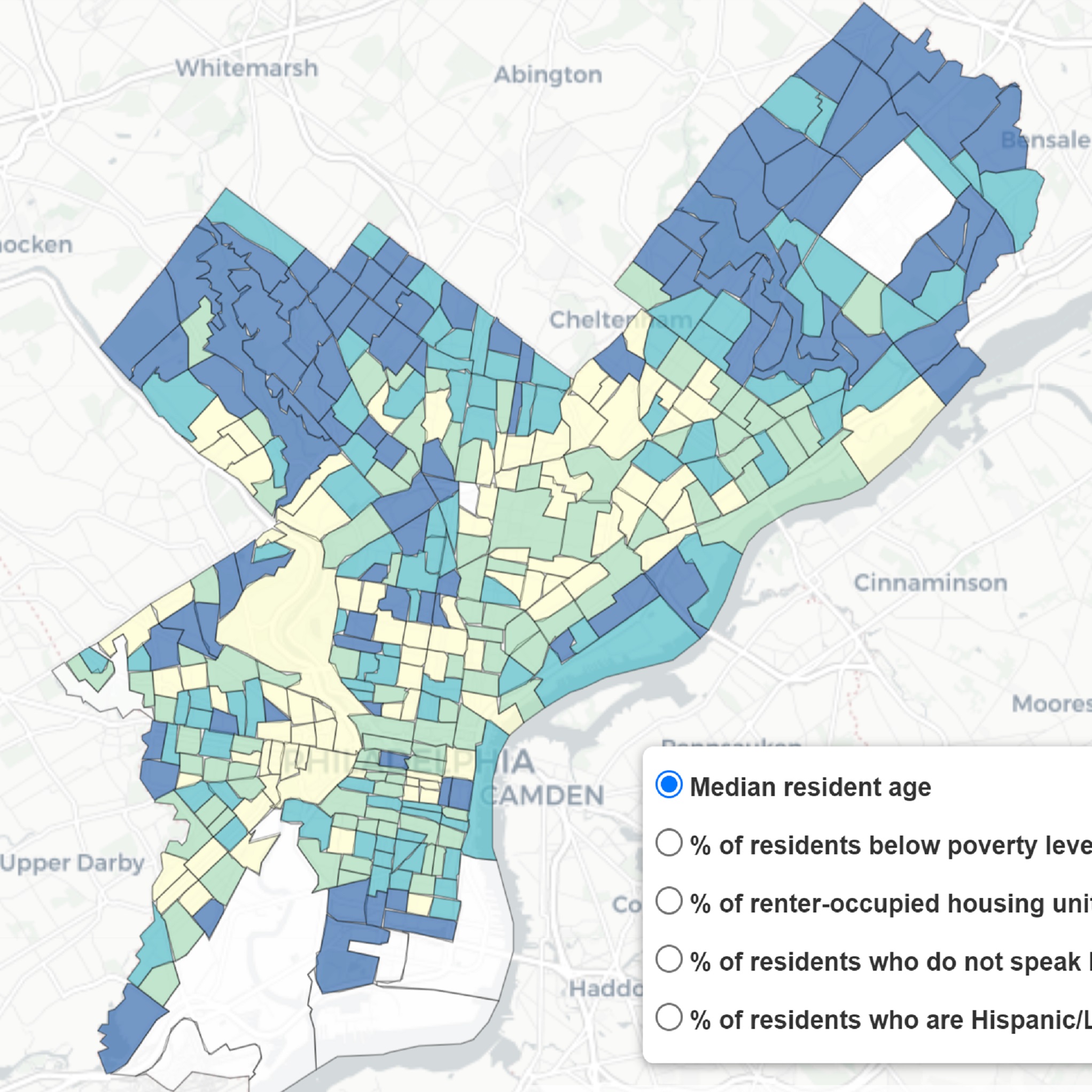
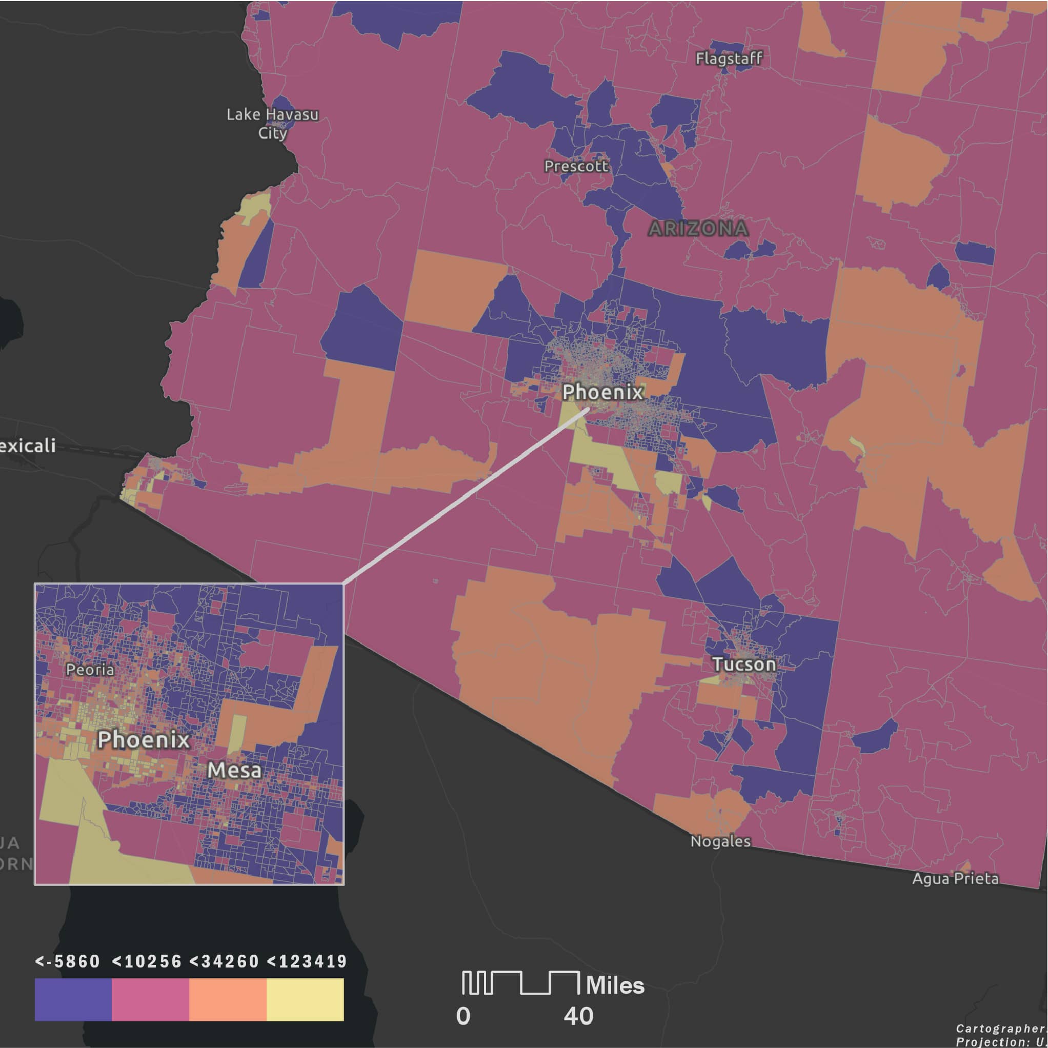
Exploring Arizona environmental justice characteristics
Web Mapping, Data Analysis, Code Development
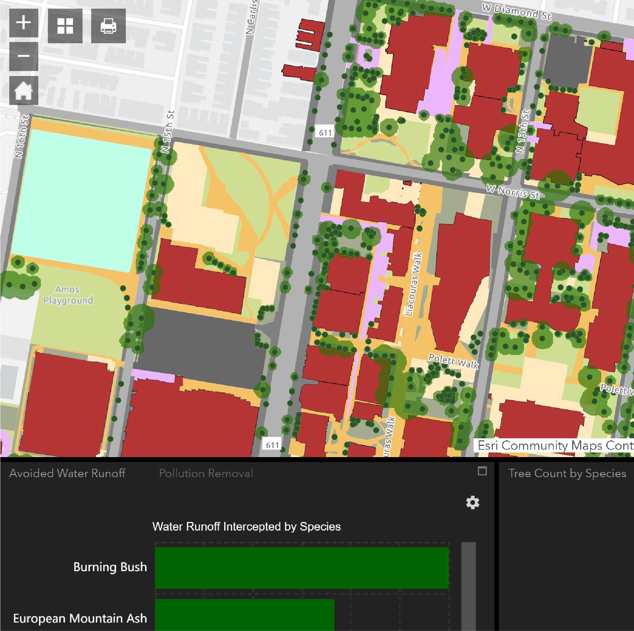
Temple University Tree Benefits
Web Mapping
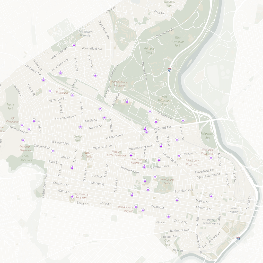
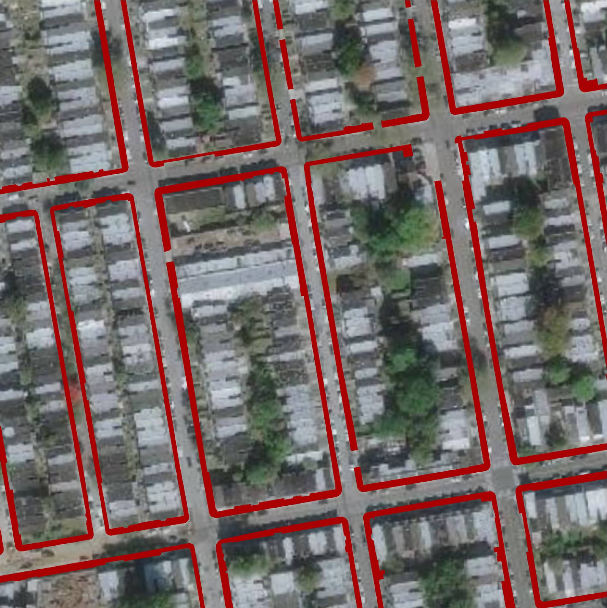
Estimating sidewalk width for street tree plantings
Data Analysis
Internal Parks & Recreation sites Experience Builder
Web Mapping
Static maps for the Temple University Facilities Information Research & Management Office
Cartography
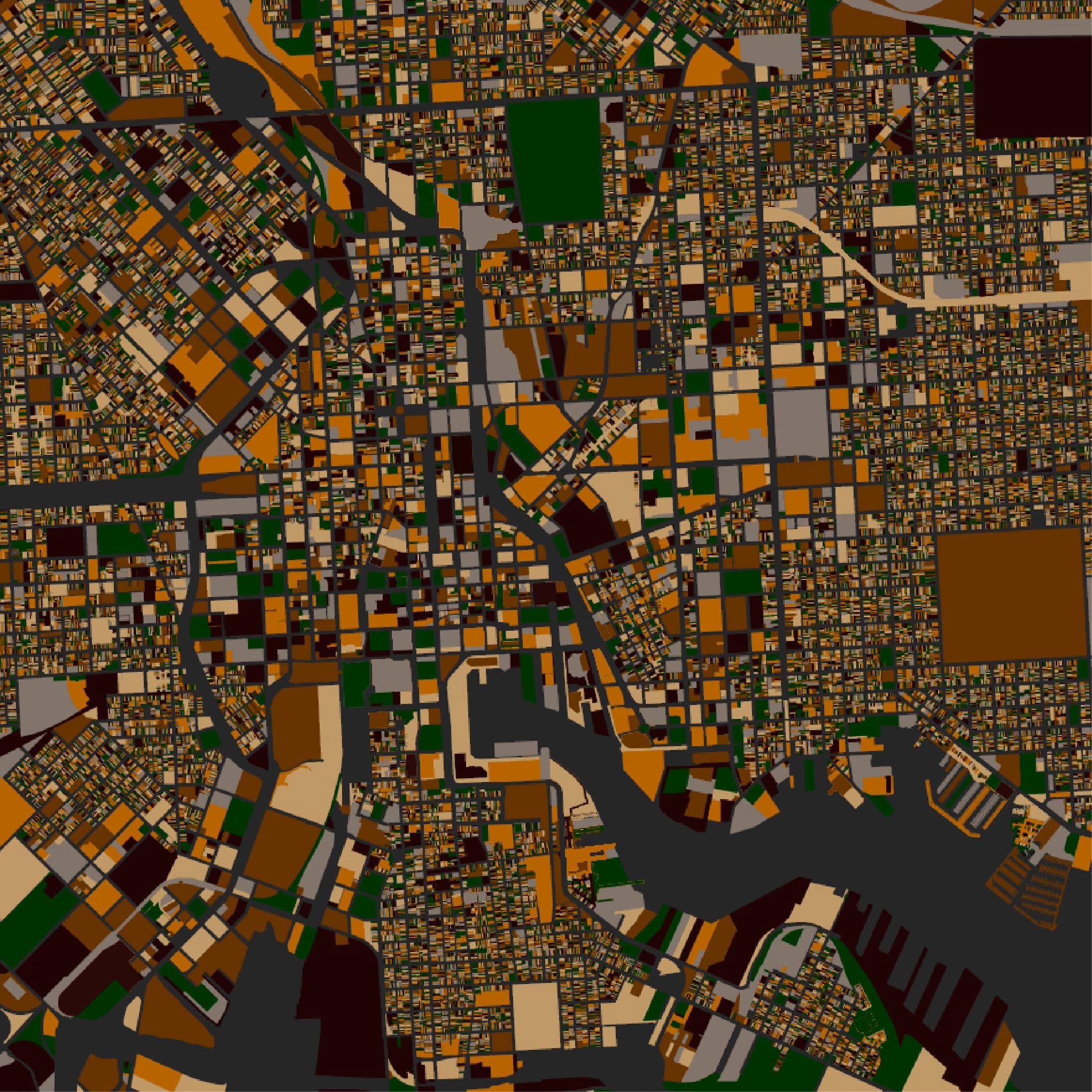
Downtown maps: Philadelphia & Baltimore
Cartography
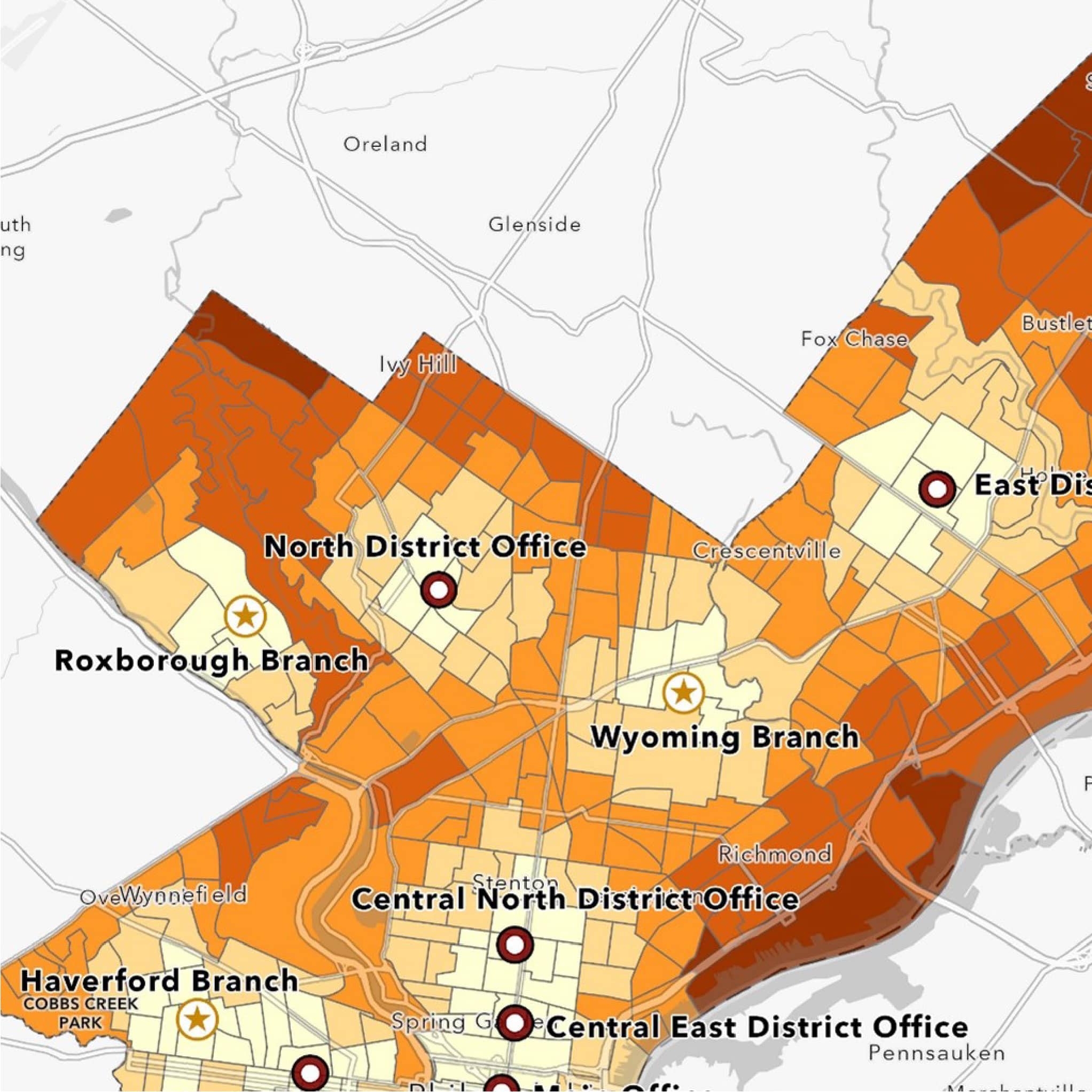
Location Allocation Analysis: L&I Offices in Philadelphia
Data Analysis