Static Maps for NRECA International's National Least Cost Planning Project in the DRC
Cartography
While serving as the Geospatial Stylization Consultant for NRECA International, an electric co-op whose mission is to empower communities by providing electricity infrastructure to rural areas throughout the world, I designed multiple static map templates, SVG symbols for layers, basemaps, labelling schemes, and color schemes for the National Least Cost Planning projects in Ethiopia and the Democratic Republic of the Congo (DRC). This project includes mapping the proposed electricity infrastructure for towns across both countries, so map styles would have to consistently work across all towns and larger cities.
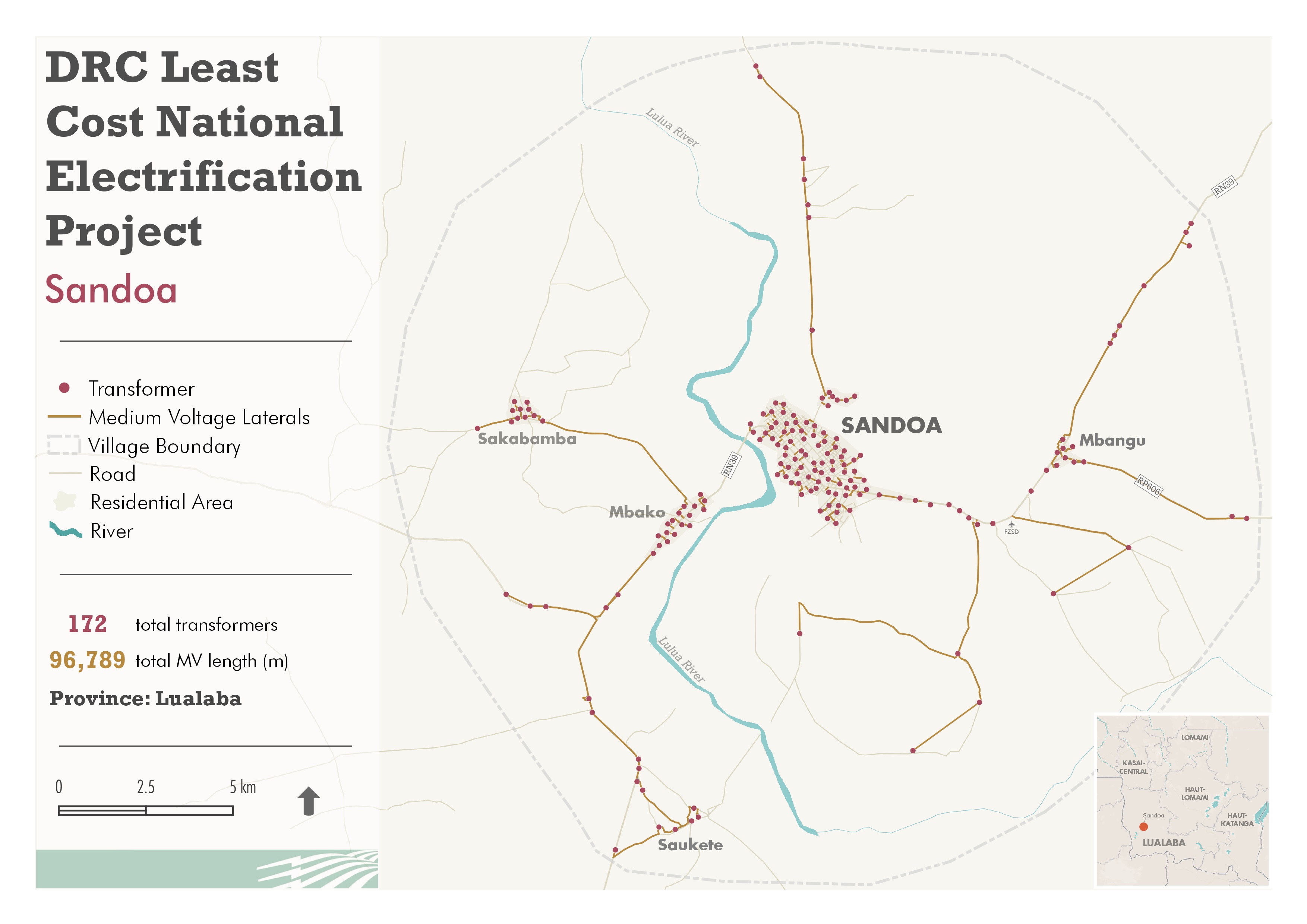
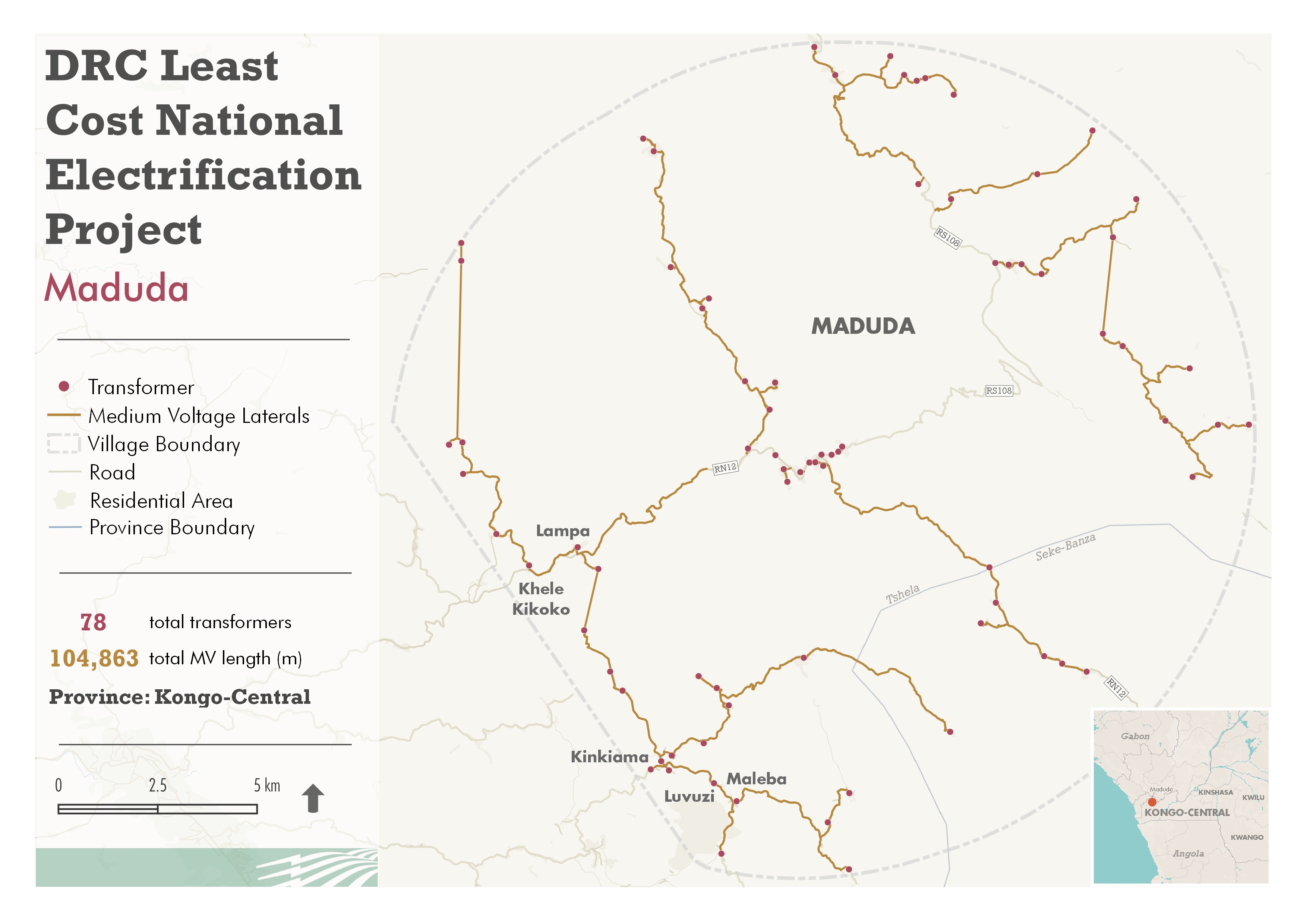
Featured below are maps of proposed transformers and medium voltage laterals for two towns in the DRC. The maps are early representations of how to style a subset of the data and do not represent the official SVG symbols, color schemes, and other style elements that were chosen for the projects.
The style is based on one of the map template variations in which the color scheme was specified by NRECA International and the basemap is a customized version of an OpenStreetMap basemap. The basemap was created in MapBox Studio, the legend symbols for the basemap were created in QGIS and Adobe Illustrator, and the maps were created in QGIS. All transformer and medium voltage lateral data belongs to NRECA International.
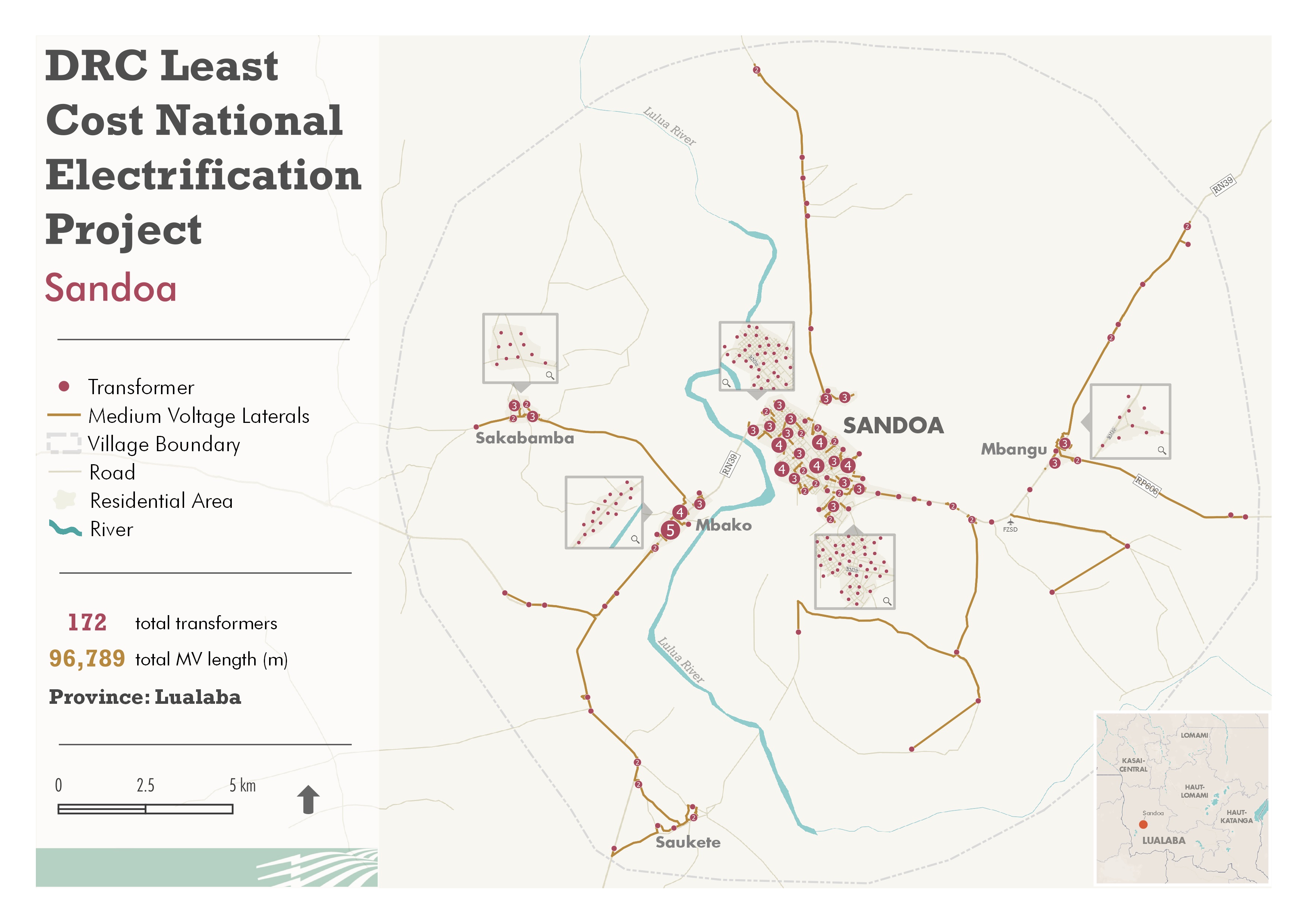
Clustered Transformer Map of Sandoa, DRC
The clustered transformer map of Sandoa represents an approach in which transformer points that are too close to one another are grouped and numbered by how many transformers are within each group. This approach is intended to avoid the overlapping of too many transformer point features so that their quantity and general location is easier to understand.
QGIS's point clustering symbology was used for this method. The mini inset maps to show an unclustered, zoomed-in extent of the clusters were designed in QGIS.