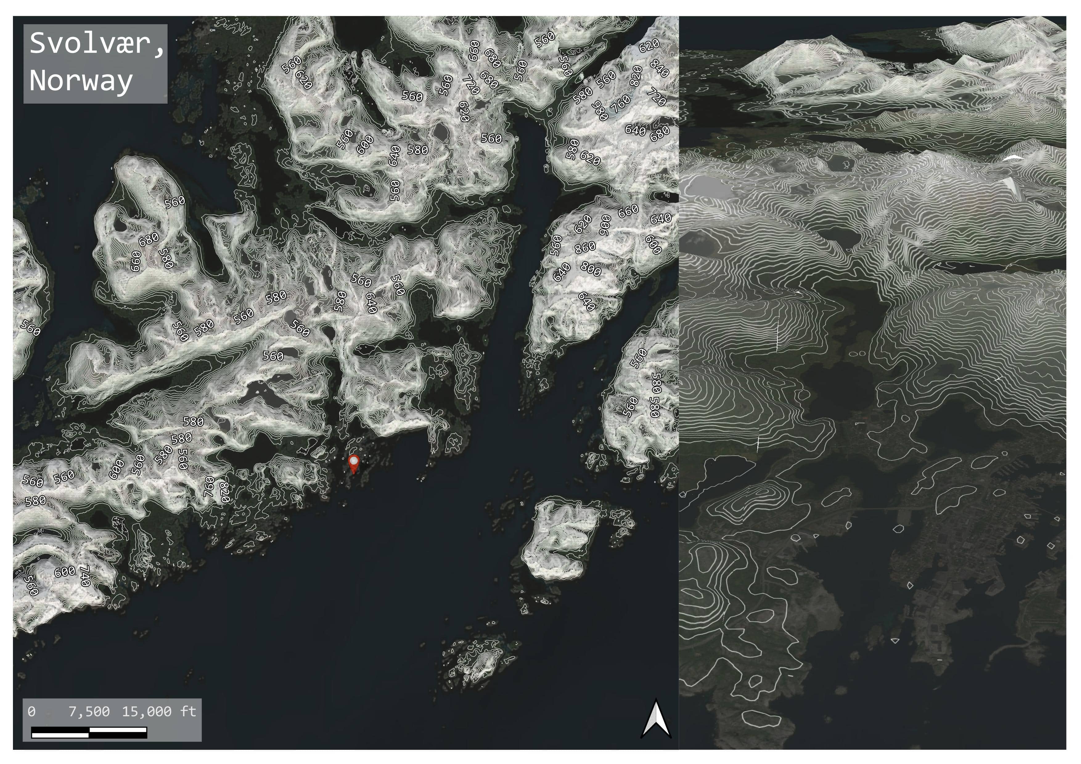
Topography study: Svolvær, Nordland, Norway
Cartography
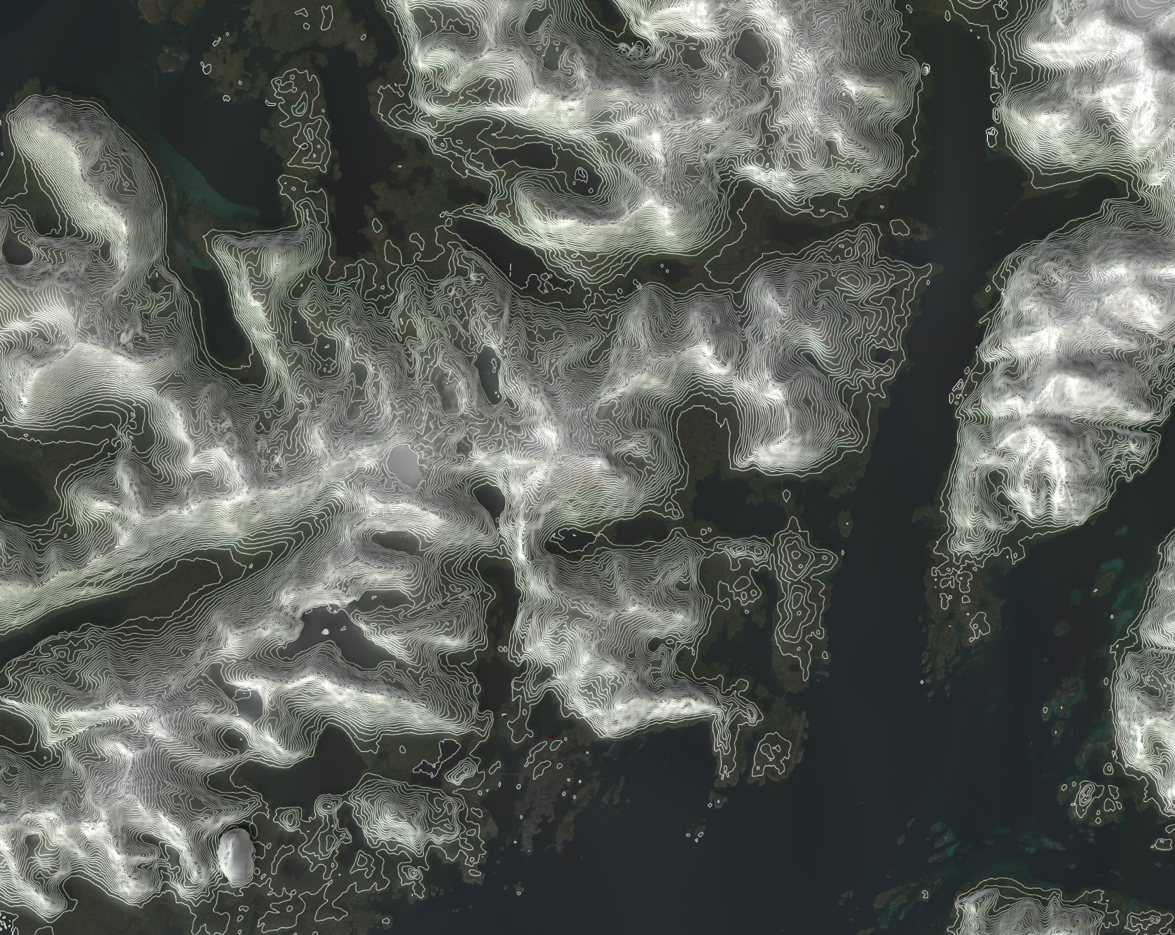
Following a trip I took to the Lofoten Islands in Nordland County, Norway, I wanted to map the region's unique topography in 3D. Svolvær, which is located on the island of Austvågøya, is the focus area of this topography study.
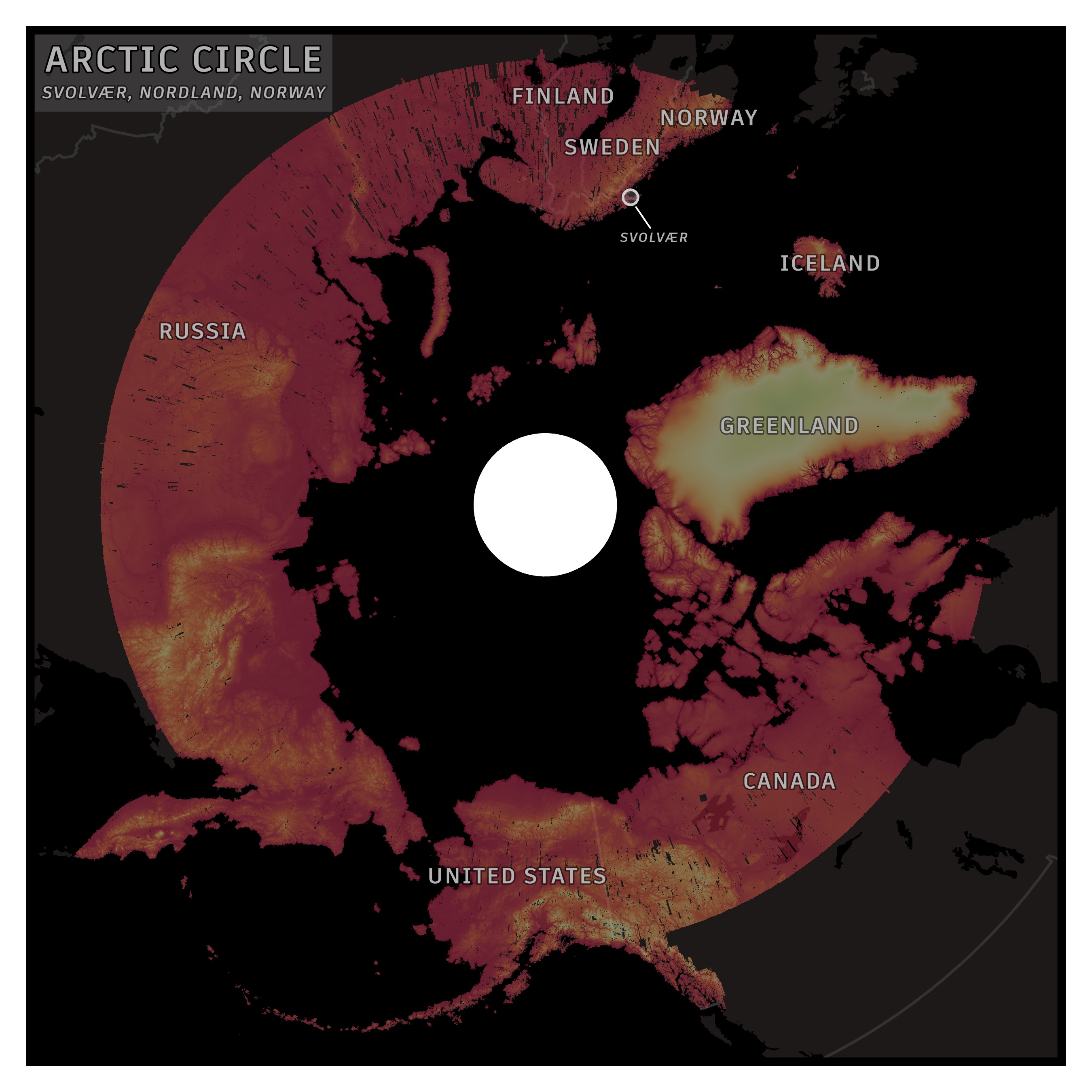
Reference Map: Arctic Circle
Contour lines are derived from an Arctic DEM, which was obtained from University of Minnesota's Polar Geospatial Center.
ArcGIS Pro was used to design the reference map, and QGIS was used to generate the contour lines (25m) and map the area in 3D.
Using QGIS's 3D Map View and Qgis2threejs plug-in, I mapped the area's unique topography in 3D and included labels for elevation above 550 meters.
Aerial imagery and the DEM were overlaid with white contour lines to emulate snow.