Internal Parks & Recreation sites Experience Builder
Web Mapping
The Philadelphia Parks & Recreation (PPR) GIS team maintains a properties layer, which represents all parks maintained by PPR and all other sites that PPR owns. PPR staff who manage funding, operations, programming, and park maintenance requested an internal web mapping application to easily locate their properties and find relevant information about each property, such as the asset ID, the acreage, and the use type. I developed the internal web mapping application using ArcGIS Experience Builder.
Because the app is internal, it could not be embedded, but the screenshots below provide insight into what the app looks like and how it functions.
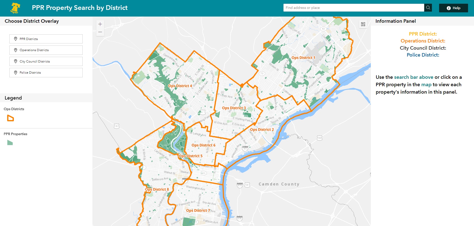
This application uses different types of reference boundaries that PPR staff commonly use - PPR programming districts, PPR Operations districts, Philadelphia Police Department (PPD) districts, and Philadelphia City Council districts - which are buttons that can be toggled at the top left of the app to help the user locate and contextualize the property of interest.
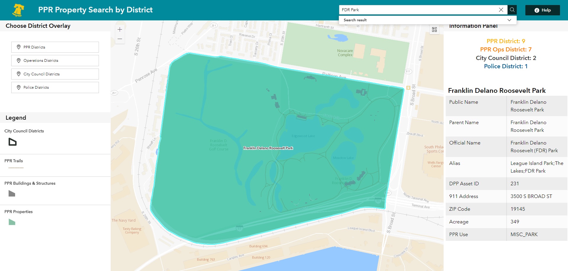
The user can use the search bar at the top right of the app to find the property of interest. Property aliases (or shorter names that are used more by the public than by PPR) and full names both work.
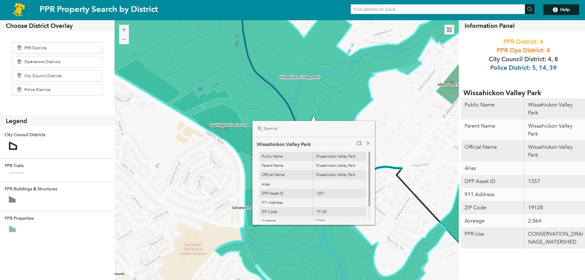
The user can alternatively pan and click on the property within the map to find its information. Regardless of whether the property is selected using the map or search bar, the property information appears in a table and in formatted text on the panel to the right. The formatted text finds which reference layers (PPR, Operations, PPD, or City Council districts) intersect with each property.
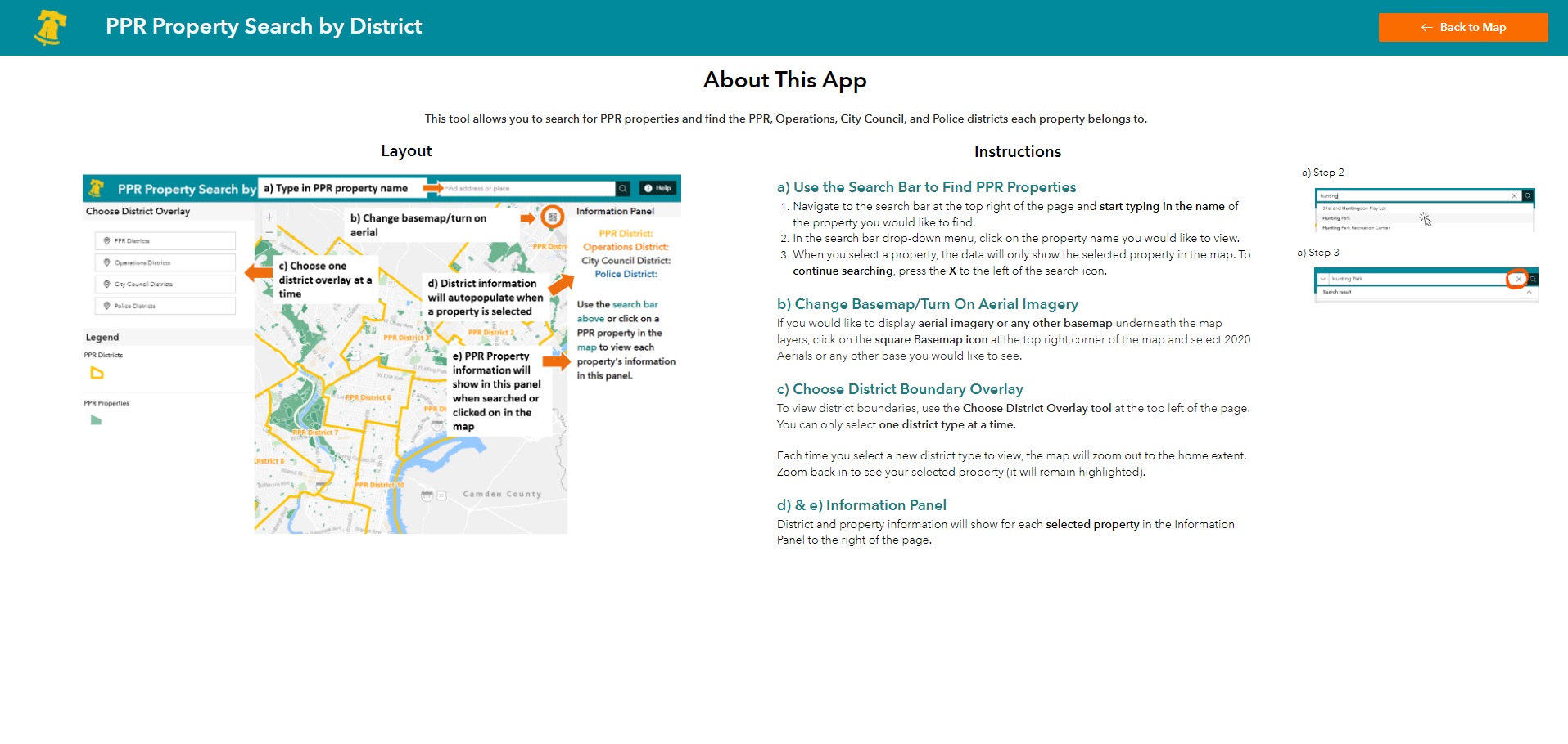
A splash screen and an About page are included to assist the user in navigating the tool.