Location Allocation Analysis: L&I Offices in Philadelphia
Spatial Analysis
Below is a lab completed for Urban GIS (Fall 2019); in this lab, I determined the locations of 4 temporary Licensing & Inspection (L&I) offices (which would be located at existing Free Library of Philadelphia branches) to serve in addition to the existing L&I offices. A Location Allocation analysis (using Dijkstra's Algorithm) was performed to determine new locations and to highlight the need for new offices in underserved parts of the city.
Existing Facilities
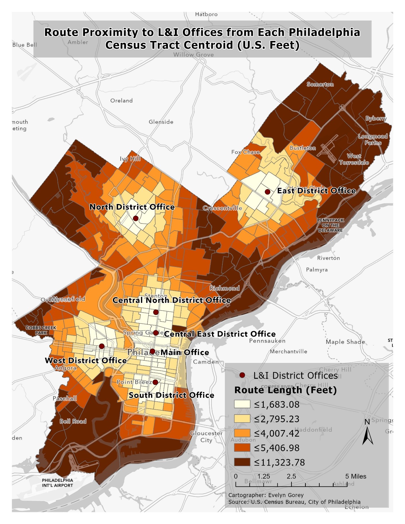
The map to the left displays the results of a Closest Facility analysis (a Network Analyst tool) to measure route length in feet from each existing L&I District Office to each census tract using the Philadelphia road network. The results show that regions such as Northeast Philadelphia, some of South Philadelphia, some of Northwest Philadelphia, and the River Wards areas could benefit from another office. This analysis takes into consideration distance by car only; public transit and population demographics are not included. The census tracts are shown in the choropleth map with five quantile breaks.
Proposed Facilities
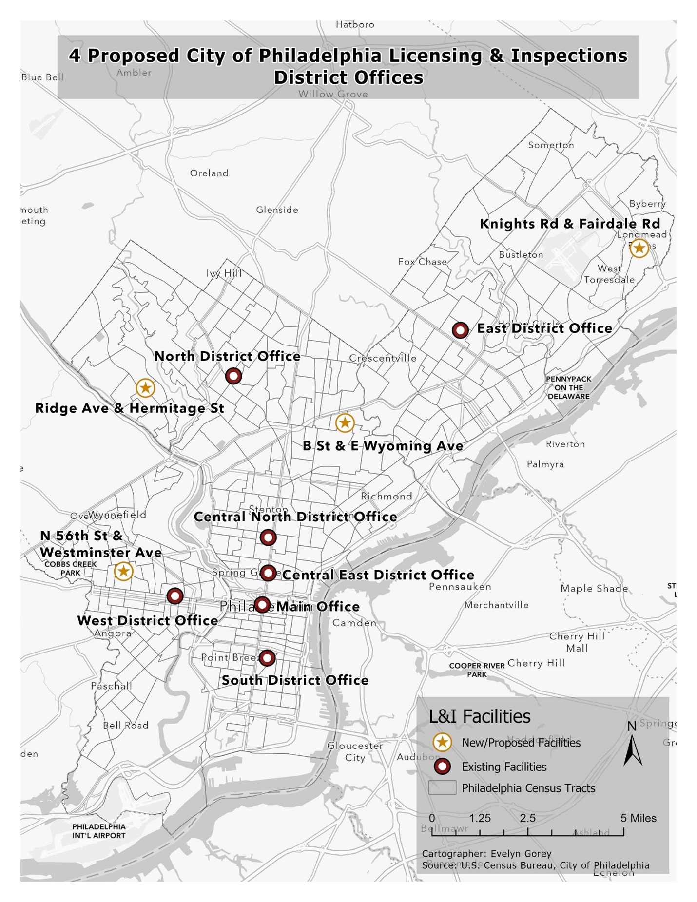
The map to the left shows 4 temporary L&I district offices (housed within existing Free Library of Philadelphia branches) to accompany the existing L&I offices. To determine the temporary office locations, a Location Allocation analysis was performed using the census tracts' centroids.

New Facilities
The map to the left depicts the new route lengths in feet from each census tract centroid to the L&I offices (with the chosen temporary library branch offices included). Again, the choropleth map breaks down the cesnus tracts into five quantiles. The map results show that there are still areas under-served, but the addition of 4 new offices in areas that were previously lacking does help decrease the route lengths for more areas.